Portfolio
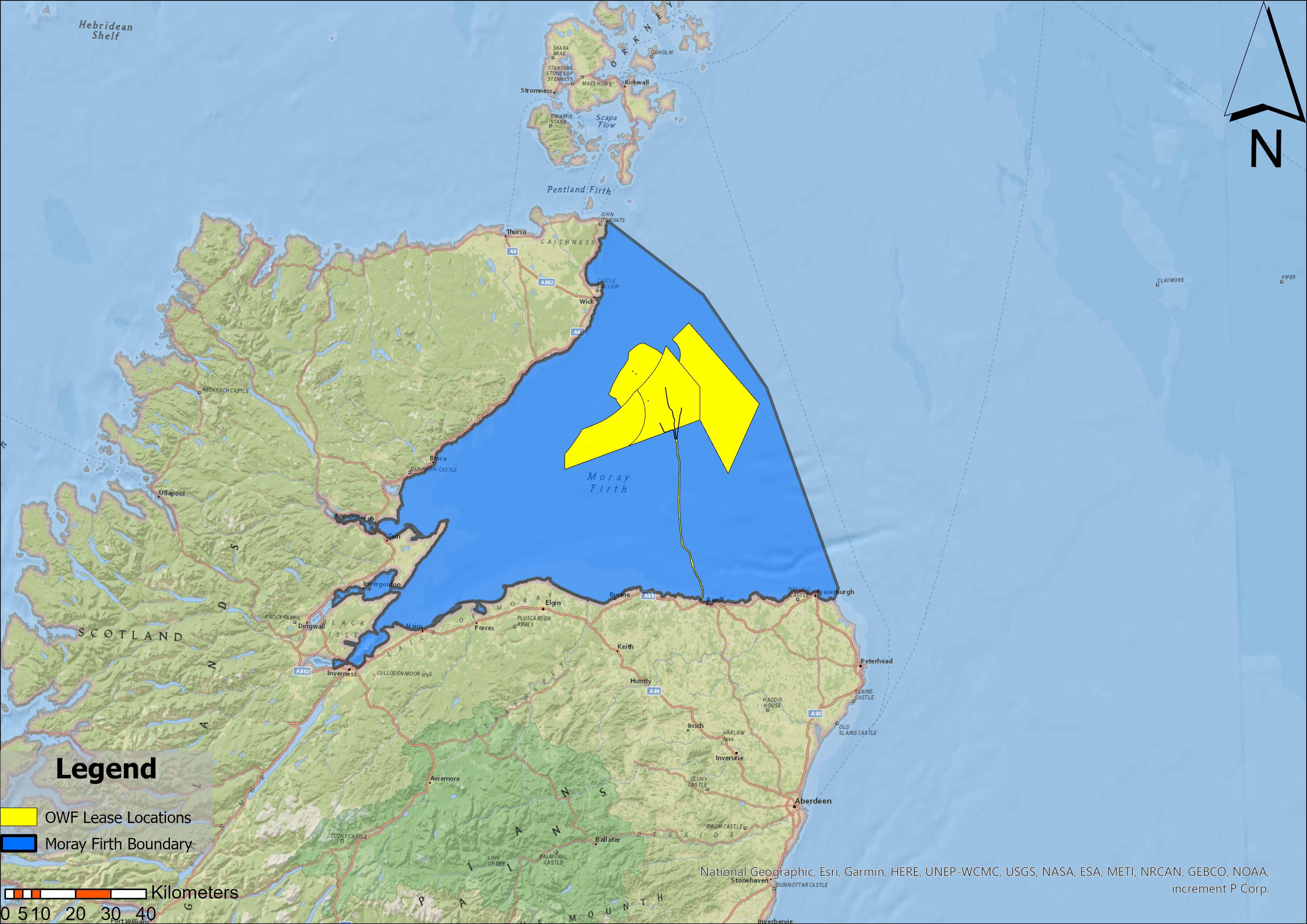
Moray Firth Offshore Wind — Spatial Conflict Analysis
University of St Andrews Dissertation, 2026–27
A GIS-based Multi-Criteria Evaluation of spatial conflicts between proposed offshore wind development and existing maritime uses in the Moray Firth. The analysis integrates vessel traffic data, fishing activity, navigational routes, and environmental constraints to produce a weighted suitability surface identifying low-conflict development zones.
Methods: MCE weighted overlay, DBSCAN clustering, kernel density estimation
Tools: Python (geopandas, rasterio, scikit-learn, matplotlib), QGIS
Interactive map and full write-up coming soon.
East Anglia Onshore Wind Farm — Spatial Suitability Analysis
GG3209 Spatial Analysis with GIS, University of St Andrews, December 2025
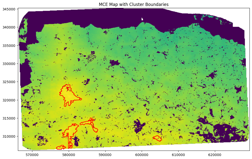
A GIS-based Multi-Criteria Evaluation identifying optimal sites for onshore wind farm development across a study area in coastal East Anglia. The region was selected for its proximity to existing offshore wind infrastructure and its position between London and Birmingham — two of the UK’s highest energy demand centres.
The analytical challenge was that broad suitability across the study area was high. It was necessary to filter to locations exceeding 80% suitability before meaningful analysis between sites was possible. DBSCAN clustering was then applied to spatially group high-suitability pixels into discrete candidate zones, which were ranked by mean suitability score.
MCE Factor Weightings
| Factor | Weight | Rationale |
|---|---|---|
| Slope | 0.35 | Steep terrain significantly increases construction cost and turbine performance loss |
| Power proximity | 0.30 | Grid connection is the dominant infrastructure cost for onshore wind |
| River proximity | 0.15 | Flood risk and ecological constraints increase with proximity |
| Wind speed | 0.10 | Spatial variation across the AOI was limited, reducing discriminatory power |
| Road proximity | 0.10 | Access required but less cost-determining than grid connection |
Areas of Outstanding Natural Beauty were treated as a hard boolean constraint rather than a weighted factor — excluded entirely regardless of suitability score.
Key finding: The study area supports both large-scale centralised development and a distributed cluster approach. A distributed model offers grid resilience benefits and reduced transmission losses, while a single large site benefits from economies of scale in construction and maintenance. The analysis identifies candidate zones for both strategies.
Methods: MCE weighted overlay, boolean constraint masking, DBSCAN clustering,
kernel density estimation
Tools: Python (geopandas, rasterio, scikit-learn, matplotlib), QGIS